
Hwangnyeongsan: Busan’s Free Night View, Open All Night
A 427m summit in the middle of four districts, with a viewing deck that never closes and a cafe that runs to 02:00
| Cost | Nothing. The viewing deck, the plaza and the beacon mound have no admission and no gate. |
|---|---|
| Hours | The deck and the mound are open around the clock. Only the cafe building has hours, 11:00 to 02:00. |
| Height | 427m, on the boundary of four districts, so the view runs from Gwangan Bridge to the western sunset. |
| Best arrival | About 30 minutes before sunset. Sunset falls at 17:13 in December and 19:40 in June. |
| Getting up | Taxi from Geumnyeonsan Station, 10 to 15 minutes for around 6,000 to 7,000 won. |
| Getting down | Village bus Yeonje-gu 1 runs until 23:15. After that it is a taxi. |
1. A free viewpoint in the middle of the city
2. What is actually at the top
3. The arrival time decides the whole trip
4. What you see, direction by direction
5. Four ways up, and the one that suits you
6. Getting down after dark
7. The beacon mound, and why this hill in particular
8. The building with the cafe in it
9. Parking, and when it fills
10. Photographing it
11. Season by season
12. The cable car plan, and what it means for a visit now
13. Building an evening around it
Busan’s best-known night view costs nothing and has no closing time. This page is part of our complete Busan travel guide.
1. A free viewpoint in the middle of the city
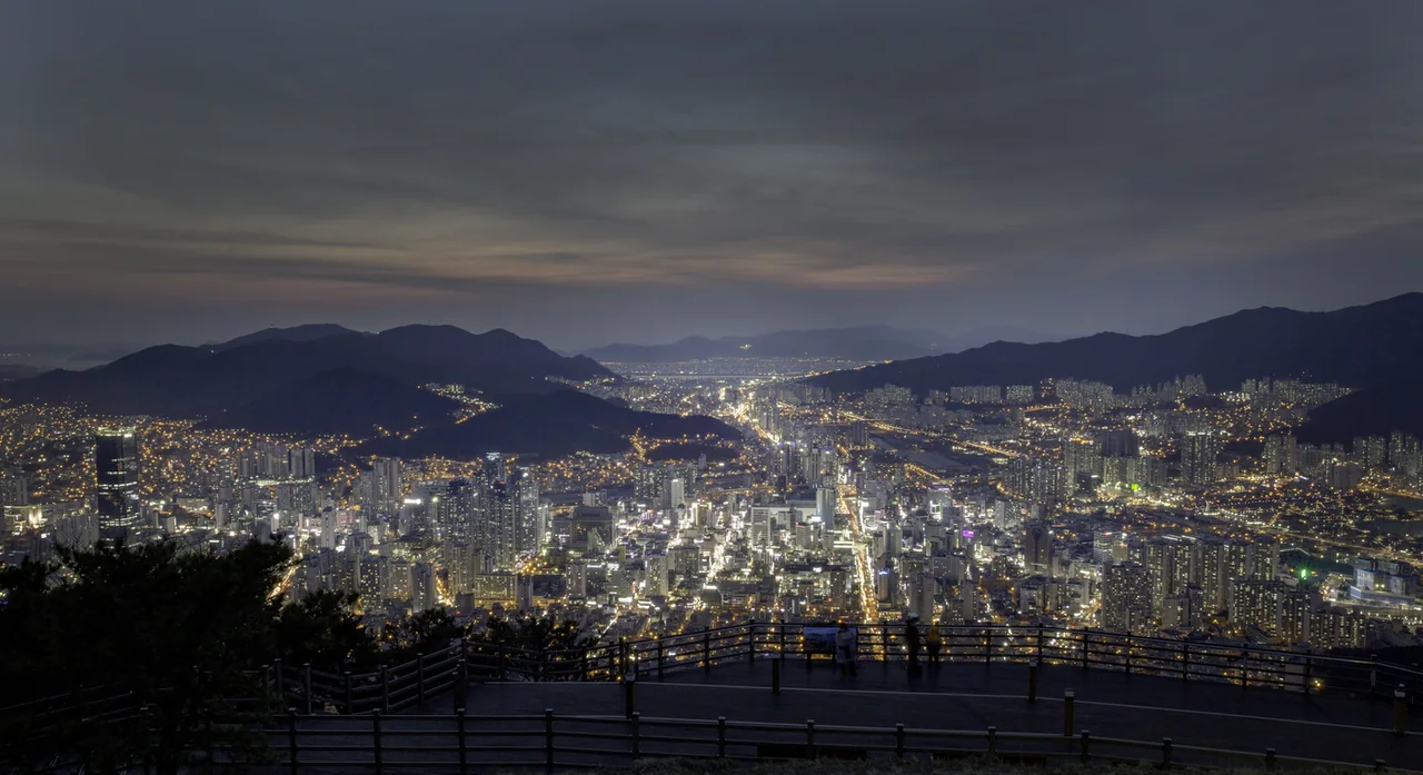
HwangnyeongsanMap is 427m high, sits inside the city rather than outside it, and charges nothing at any hour. There is no ticket office, no gate and no closing announcement. The viewing deck and the beacon mound at the summit are public ground.
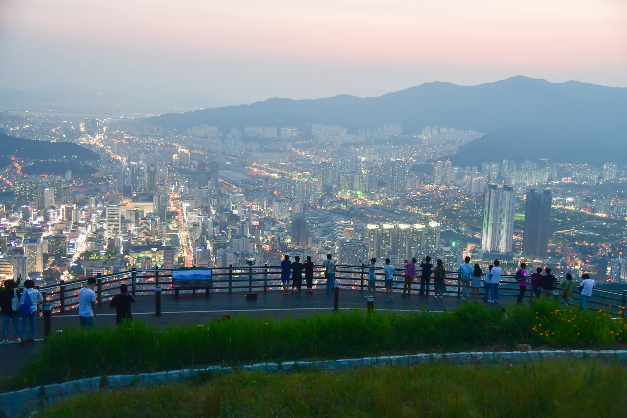
The mountain sits on the boundary of four districts at once: Busanjin-gu, Yeonje-gu, Nam-gu and Suyeong-gu. That is the reason the view is what it is. Most city viewpoints look at one side of town. This one has Gwangan Bridge and the Marine City towers on the eastern side, the harbour bridge to the south, and the sun going down over the western half of the city behind you.
| Detail | |
|---|---|
| Height | 427m |
| Admission | None, at any hour |
| Viewing deck | Completed 10 November 2016, open around the clock |
| Observatory building | Opened August 2015, floor area 276㎡, one floor above ground and one below |
| Cafe inside it | 11:00 to 02:00 daily, last order 01:30 |
| Parking | Free, roughly 350m below the beacon mound |
What that combination means in practice is that the mountain answers a problem the rest of the city cannot. Every paid observation deck in Busan closes in the evening. This one does not, which is why the cafe up here keeps serving until two in the morning.
2. What is actually at the top
Three separate things sit within 400m of each other, and they are easy to confuse before you arrive. People book a trip for one and end up describing another.
The viewing deck
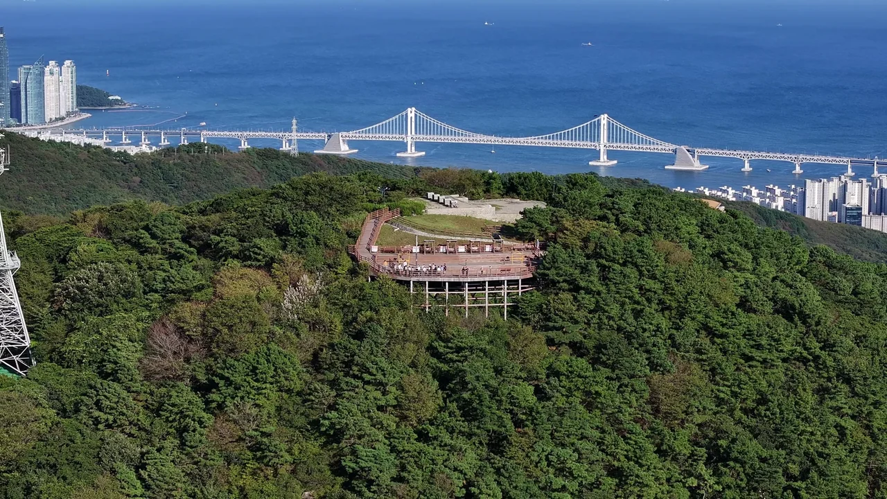
A curved wooden deck built out on stilts below the summit, finished on 10 November 2016. It has benches and it faces east and south, which is the Gwangan Bridge side. This is the structure in most photographs of the mountain. No hours, no fee.
The observatory building
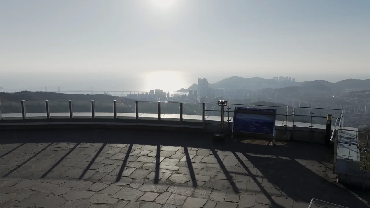
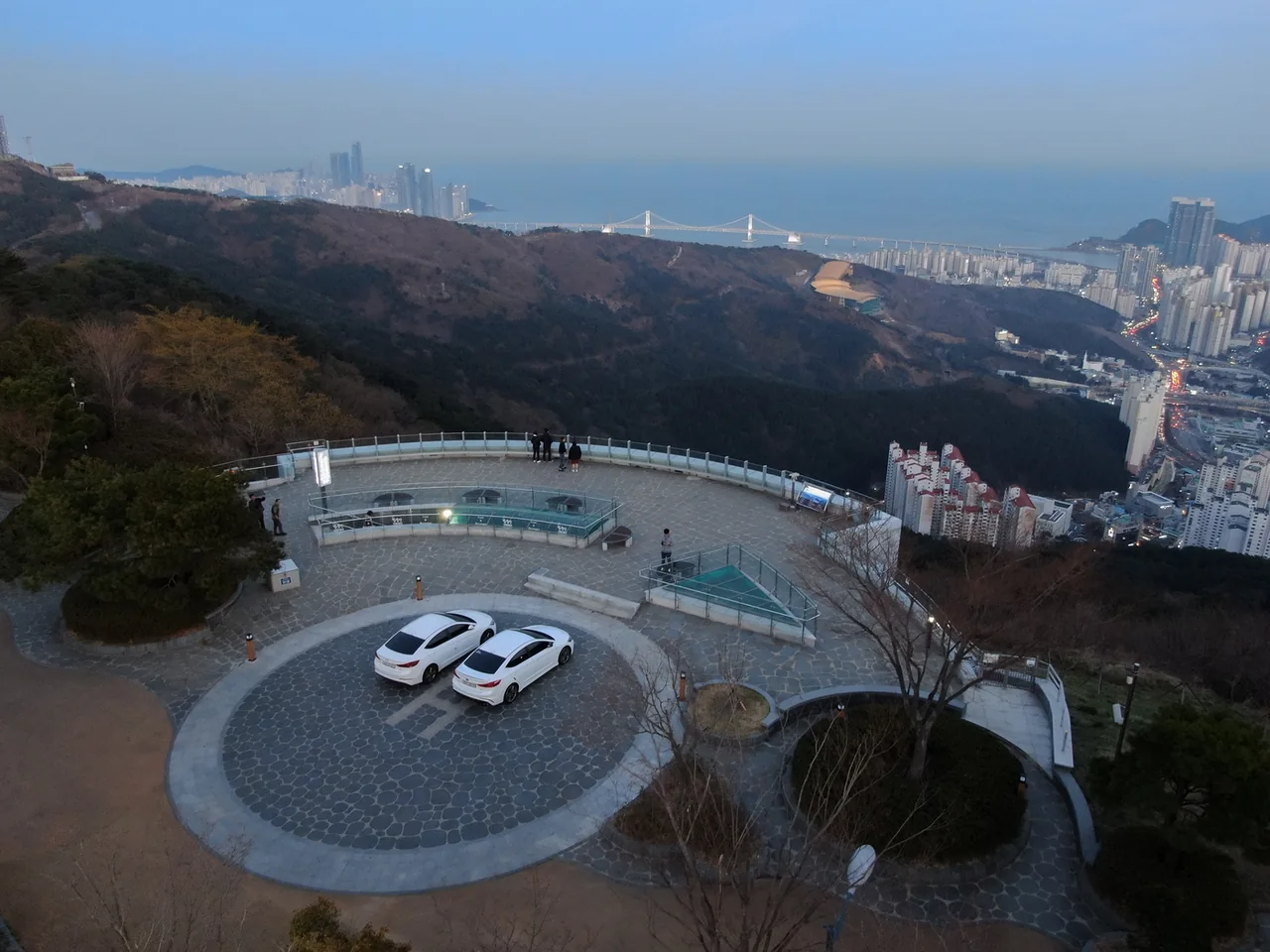
A small building opened in August 2015 and run by the Busan Tourism Organization, with a floor above ground and a floor below, 276㎡ in total and room for gatherings of about 80 people. A cafe occupies the lower floor. Above the cafe there is an open roof plaza with a coin telescope, an orientation panel and a media photo zone.
The beacon mound
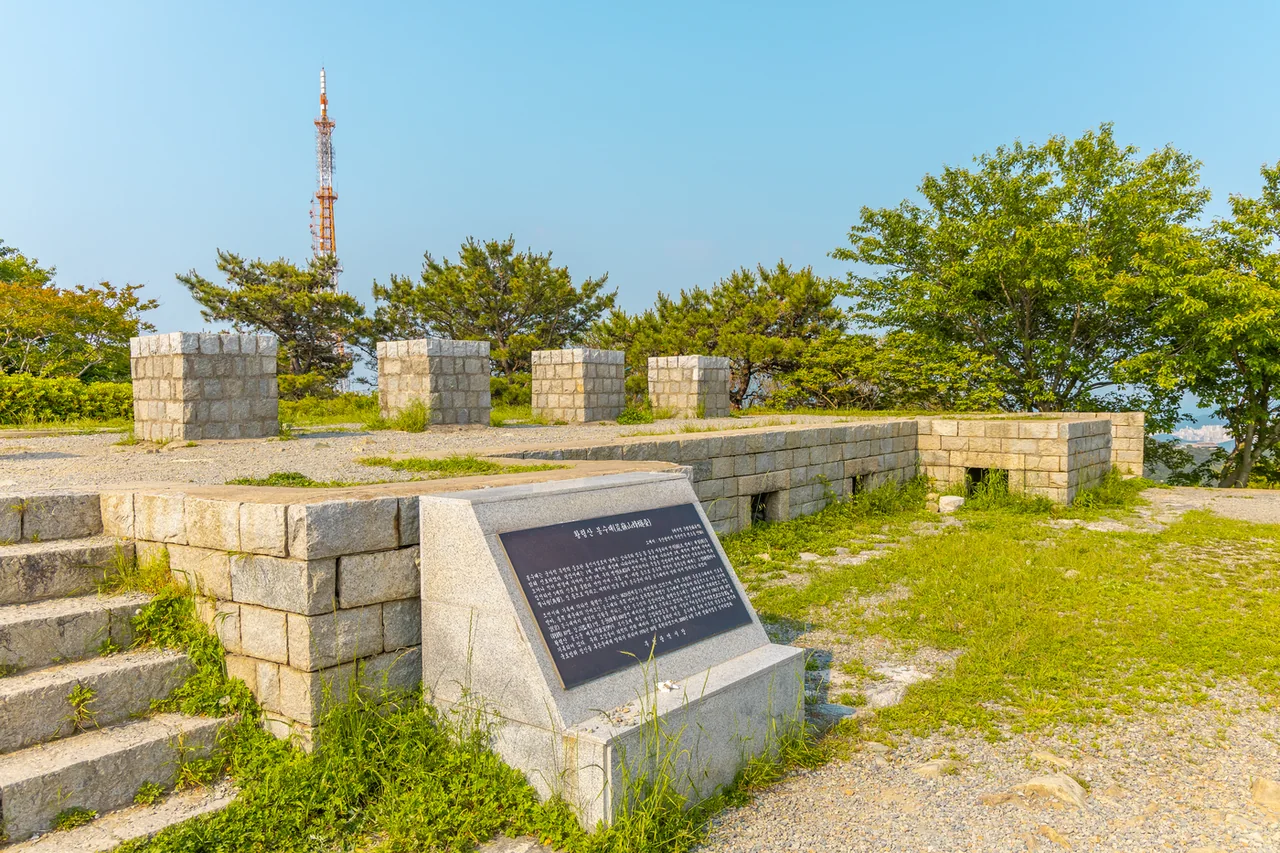
A restored Joseon-era signal station on the summit itself, about 50m above the observatory building and around 350m from the car park. Stone steps, an information board, a marker stone and two figures of beacon soldiers stand at the foot of the stairs.
Broadcast transmission towers for KBS, MBC and KNN stand beside all of this. They are the reason the summit is lit and easy to find from below at night, and they appear in every wide photograph taken here.
3. The arrival time decides the whole trip
The interval you want is the 26 to 29 minutes between sunset and the moment the sky goes dark. That is when the sky is still holding light and the city lights have already come on, and it is the only window in which both the bridge and the sky show up in the same photograph.
Sunset in Busan moves by more than two and a half hours across the year, so a fixed rule like “go at seven” fails for half the calendar. These are the official times from the Korea Astronomy and Space Science Institute, taken on the fifteenth of each month.
| Month | Sunset | Sky goes dark | Aim to arrive |
|---|---|---|---|
| January | 17:34 | 18:02 | 17:05 |
| February | 18:06 | 18:32 | 17:35 |
| March | 18:31 | 18:56 | 18:00 |
| April | 18:56 | 19:22 | 18:25 |
| May | 19:20 | 19:49 | 18:50 |
| June | 19:40 | 20:09 | 19:10 |
| July | 19:39 | 20:08 | 19:10 |
| August | 19:13 | 19:40 | 18:45 |
| September | 18:31 | 18:57 | 18:00 |
| October | 17:49 | 18:15 | 17:20 |
| November | 17:18 | 17:45 | 16:50 |
| December | 17:13 | 17:41 | 16:45 |
Two things follow from that table. In December the sun is down at 17:13, which means the night view starts before dinner and you can be back in the city by seven. In June it is 19:40, so an evening here replaces dinner rather than preceding it.
The half hour of margin in the last column is not padding. It covers the walk from the car park, and it gets you a place at the deck rail before the people who arrive exactly at sunset.
4. What you see, direction by direction
The summit is open on every side, and the four directions are four different cities. Knowing which way to stand saves you walking the loop twice.
| Facing | What is in front of you |
|---|---|
| East and southeast | Gwangalli Beach, the full span of Gwangan Bridge, and the Marine City towers behind it |
| South | Busan Harbour Bridge and the Yeongdo side of the port |
| West | The Seomyeon city centre and the sunset over western Busan |
| North | The Dongnae district and the ridge line running inland |
The practical consequence is a sequence rather than a spot. The sun sets on the western side, so that is where you stand first. Gwangan Bridge lights up on the eastern side, so that is where you finish. The walk between the two takes a couple of minutes.
The bridge is the reason most people come. From here you get the whole crossing in one frame, which is not possible from the beach itself, where you are too close and too low. If you want the beach-level version as well, that is the photo spots circuit rather than this one.
5. Four ways up, and the one that suits you
There is a road to the top, which is unusual for a mountain of this height, and it changes every calculation. You do not have to hike unless you want to.
| Method | From | Time | Cost |
|---|---|---|---|
| Taxi | Geumnyeonsan StationMap, line 2, Exit 6 | 10 to 15 minutes | About 6,000 to 7,000 won |
| Village bus plus walk | City Hall Station, line 1, Exit 6, then Yeonje-gu 1 to the Mulmangol terminus | Bus, then 20 to 40 minutes on foot | Bus fare |
| On foot | Hwangnyeongsan Leisure Sports ParkMap | 30 to 40 minutes | None |
| Own car | Hwangnyeongsan-ro | Depends on traffic below | Parking is free |
The taxi is the default for a visitor. Six or seven thousand won split between two people is less than the price of a coffee at the top, and it puts you at the door in a quarter of an hour. Geumnyeonsan Station is on line 2, one stop from Gwangan, so the bridge and the mountain fit into the same evening.
The village bus is the cheap version and it has a real timetable. Yeonje-gu 1 runs between the Mulmangol terminus and City Hall Station by way of Yeonsan telephone office, first bus 06:00, last bus 23:15, every 15 minutes, with a single circuit taking 30 minutes over a 6.2km round trip. From the terminus you are still 20 to 40 minutes of uphill walking away, on a trail, in the dark on the way back down.
For how the metro, the transit card and taxis fit together across the rest of the city, see the Busan metro and transit card guide.
6. Getting down after dark
Three clocks matter on the way down, and only one of them is early.
| What | Until |
|---|---|
| Village bus Yeonje-gu 1, last departure | 23:15 |
| Cafe in the observatory building, last order | 01:30 |
| Cafe closing | 02:00 |
| Viewing deck and beacon mound | No closing time |
Line up those numbers against the sunset table and the summer problem disappears. Even in June, when the light does not go until 20:09, the last bus is still three hours away. The mountain is not a place you can get stranded on by staying for the view.
What you can get stranded by is walking. If you came up the trail, the descent is unlit and you will want a taxi instead. Call one from the observatory building rather than starting down and hoping, because reception and pick-up are both easier at the car park than on a footpath.
7. The beacon mound, and why this hill in particular
The summit was a communication relay before it was a viewpoint, and the reason is the same one that makes the view good. It can see in every direction.
A beacon station stood here before 1425, the seventh year of King Sejong’s reign, which is when the records already describe it as established. Fires lit at the top passed a message along a chain of hills faster than a rider could carry it.
The geography of that chain is still legible from the deck. Signals arrived from the Gubong station above Choryang, near where the old town sits today. From here they went two ways: east to Ganbio-san above Haeundae, and north to Gyemyeong-san beyond Beomeosa temple. Stand on the deck and you are looking at the sending and receiving points at the same time.
| Detail | |
|---|---|
| First recorded | Before 1425 |
| Signal received from | Gubong station, Choryang |
| Signal sent to | Ganbio-san, Haeundae, and Gyemyeong-san, north beyond Beomeosa |
| Staffing | 10 officers, 1 supervisor, 100 beacon soldiers on rotation |
| Restored | October 1976, after a survey for the centenary of the port’s opening |
| Grounds work | June 2000 |
The staffing figure is the one that changes how the site reads. A hundred beacon soldiers on rotation is not a watchman on a hill. It is a garrison, kept fed and housed at 427m, for a station whose entire output was whether or not a fire was burning.
What stands there now is a reconstruction. It went up in October 1976 after an academic survey commissioned for the hundredth anniversary of the port of Busan opening, and the surrounding ground was cleaned up in June 2000. It is classified as unlisted heritage, meaning it is documented and maintained by the district rather than nationally designated.
You reach it by a flight of stone steps from the road. Two painted figures of beacon soldiers stand at the bottom next to the information board and the marker stone, which is where most people photograph it.
8. The building with the cafe in it
The observatory rest areaMap is the only heated room on the mountain, and it stays open later than anything else in Busan with a view.
It opened in August 2015 under the Busan Tourism Organization. The floor area is 276㎡ across one storey above ground and one below, and the space was built to take gatherings of around 80 people. The lower floor is a cafe, currently trading as Blueban Hwangnyeongsan, open every day from 11:00 to 02:00 with last orders at 01:30. It does not close on a weekly rest day.
Those hours are the detail most guidance still gets wrong. A lot of what circulates online lists this building as closing at 22:00 with a Monday closure, which describes an earlier arrangement rather than the current one. Two figures are worth keeping straight:
| Hours | Closed | |
|---|---|---|
| Viewing deck and beacon mound | Around the clock | Never |
| Cafe in the observatory building | 11:00 to 02:00, last order 01:30 | No weekly closure |
Above the cafe there is an open plaza with a coin telescope, a panel naming what you are looking at, and a media photo zone. There is an accessible parking bay and an accessible toilet, which makes this the practical stopping point for anyone not walking the last 350m of slope to the mound.
9. Parking, and when it fills
The car park is free and it is the bottleneck. There is no charge and no barrier, but there is a fixed number of spaces and a predictable rush.
It fills at weekends and around sunset, which are the same hours you want to be here. The distances from it are short: the observatory building is immediately adjacent, and the beacon mound is about 350m further up, with the last stretch on stone steps.
Arriving 30 minutes before sunset, as in the table above, is a parking strategy as much as a viewing one. The alternative on a Saturday in autumn is circling on a mountain road with nowhere to turn.
10. Photographing it
Everything here is a handrail problem. The deck and the roof plaza are both edged with glass and steel, and that decides where a camera can go.
- Time. The 26 to 29 minutes after sunset, from the table in section three. Earlier and the lights are not on; later and the sky is black.
- Position. The bridge sits east and southeast. From the deck it is unobstructed. From the roof plaza the telescope and the panel are in the frame unless you move to the rail.
- Glass. The barriers are partly glazed. Shooting through them at night collects reflections from the lights behind you, so shoot over them where the height allows.
- Support. After dark a phone needs something solid. The rail caps and the benches on the deck work. There is no restriction on tripods, but the deck is busy at sunset and it moves slightly when people walk on it.
- Wind. At 427m an exposed deck is colder and windier than the forecast for the city below, which matters for long exposures more than for comfort.
The wide view including the transmission towers is the one that identifies the place, and it is best from the road above the building rather than from the deck itself.
11. Season by season
The mountain does not close for the season, but four things change through the year.
| Season | What changes |
|---|---|
| Spring | Cherry trees line the approach road, which puts blossom in the foreground of the daytime view for about a fortnight |
| Summer | Sunset at 19:40 in June, the latest of the year. Warm enough to stay out on the deck, and the busiest evenings |
| Autumn | The clearest air of the year, so the far side of the bay stays sharp. Weekend parking is at its worst |
| Winter | Sunset at 17:13 in December, so the night view fits before dinner. Wind and ice on the road are the trade |
Visibility is the variable nobody plans for. On a hazy day the bridge is still there but the far towers dissolve, and no arrival time fixes that. If the day has been clear enough to see the far side of the bay from street level, it will be clear from up here.
Rain is the one condition that removes the reason to come. If the forecast is against you, the rainy day guide to Busan covers the indoor alternatives.
12. The cable car plan, and what it means for a visit now
Nothing about the current visit involves a cable car. There is a plan, it is at the approval stage, and a good deal of what is written online reads as though it already exists.
An implementation plan was approved and published on 16 July 2025. It covers a 125m observation tower shaped after the beacon mound, and a 539m cable car from the Leisure Sports Park at the foot of the trail up to the tower.
| Element | Figure | Build period |
|---|---|---|
| Observation tower, 125m | About 203.7 billion won | Within 48 months of the start of work |
| Cable car, 539m | About 134 billion won | Within 24 months of the start of work |
| Second phase, 2.2km extension to Snow Castle in Daeyeon-dong | Conditionally approved September 2025 | Not started |
The developer is Sein Development, part of the Daewon Plus group. Environmental groups have opposed the extension on the grounds that the pylons and the additional parking would take more of the hillside, and that part of the route passes high-voltage lines.
The history is worth one line, because it explains why nothing here should be treated as fixed. A tower on this summit was proposed as the Asiad Tower in 2004, then again in comprehensive tourism plans in 2012 and 2017. All three were dropped.
13. Building an evening around it
The mountain takes about an hour and a half of your evening, which leaves the rest of it open. The two obvious ways down lead to two different nights.
Down to the water
Geumnyeonsan Station is one stop from Gwangan on line 2, so the beach is fifteen minutes from the summit by taxi and metro. You will have spent the previous hour looking at Gwangalli from above; standing under the bridge afterwards is the other half of the same view.
Down to the city
Seomyeon is the western side of what you were looking at, and it is where the late food and the bars are. For the full picture of where the city goes after midnight, see the Busan nightlife guide.
Two viewpoints in one day
If you want the comparison, Igidae coastal walk gives you the same skyline at sea level in daylight, and Busan X the Sky gives you height with a ticket, indoors, closing in the evening. Hwangnyeongsan is the free one that stays open, and it is the only one of the three you can visit at midnight.
🎡Things to Do48
🍜Food7
🏨Where to Stay3
🚇Getting Around8
🧭Travel Tips14
📌More3
🧭All-Korea essentials50
Frequently asked questions
Read the complete Busan travel guide →
Images: All photographs from the Busan Tourism Archive (visitbusan.net/archive) under KOGL Type 1. Night view over the city and the viewpoint after sunset (2018), and the observatory plaza from the air (2019): Kim Min-geun, Busan citizen photographer / Busan Metropolitan City. Viewing deck with Gwangan Bridge and the plaza telescope (2025): Summertree, Lee Chang-uk / Busan Metropolitan City Tourism Policy Division. Beacon mound (2025): Hyphen Group / Busan Tourism Organization.