
Jeju Travel Guide: North or South Coast, and Everything That Follows
Hallasan splits the island in two. Seogwipo in the south gets 488mm more rain a year than Jeju City, on the same number of rainy days, and half the winter wind.
| Where to sleep | Jeju City in the north for the airport and late food; Seogwipo in the south for milder, calmer winters. |
|---|---|
| North vs south | Jeju City gets 1,502mm of rain a year, Seogwipo 1,990mm, on almost the same number of wet days. |
| Buses | Trunk and branch routes are a flat 1,150 won. Express routes start at 2,000 won and cap at 3,000. |
| Hallasan | You only need a permit for the summit. The shelters at 7.3km and 6km are open to anyone. |
| Manjanggul | Reopened after 29 months closed. 4,000 won, shut on the first Wednesday of each month. |
| The local pass | Nowda covers 27 public sites free or half price, but only Korean nationals can get it. |
1. A mountain sits in the middle of everything
2. Getting there is a flight, and the weather that cancels it
3. North or south: the numbers behind the choice
4. Six bases, and what each one gives you
5. Rent a car, or learn the bus numbers
6. The discount pass you cannot get, and why it matters anyway
7. Hallasan changed its permit rule, and most guides did not notice
8. Manjanggul reopened after 29 months
9. Seongsan Ilchulbong has a free half and a paid half
10. Udo, Mara and Gapa: three boats, three sets of rules
11. The south coast stacks waterfalls close together
12. The west is a coastal road and a sunset
13. The east is forest and cinder cones
14. The Olle trail is 27 routes and 437km
15. The haenyeo, and Jeju 4·3
16. What to eat
17. Where to go when it rains
18. What a day costs
19. When to come
20. How many days
Jeju is easy to reach and hard to plan. The airport is an hour from Seoul, but the island puts a mountain in the middle of everything. This is the Jeju chapter of our Korea travel guide.
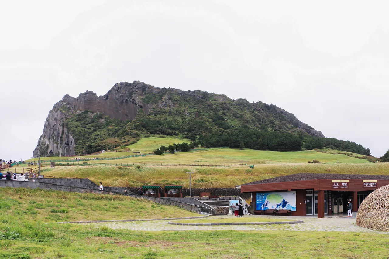
1. A mountain sits in the middle of everything
Jeju is 73km east to west and 31km north to south, and Hallasan occupies the centre of it. People live around the rim, on the coastal shelf. Nothing crosses the middle except three roads: the 5·16 Road straight over the saddle, the wider Pyeonghwa Road looping west, and the 1100 Road between them. Each takes about an hour, and the high sections close in heavy snow.
That geography is the whole planning problem. A hotel on the north coast and a waterfall on the south coast are ninety minutes apart in each direction, so a day that starts in Jeju City and ends in Jeju City loses three hours to the road. Choosing a side is not a preference. It decides what you can see.
368 smaller volcanoes
Hallasan is the big one, but 368 secondary cones dot the island. Locally they are called oreum. Most take twenty to forty minutes to climb, which makes them the practical alternative for anyone who does not want to give a whole day to Hallasan. Saebyeol is the one photographed in autumn silver grass; Sangumburi has a crater you can look into without much climbing.
Three separate UNESCO listings
Jeju was inscribed on the World Heritage list in 2007 as “Jeju Volcanic Island and Lava Tubes”. The listing covers three things: the Hallasan protected area, the Geomunoreum lava tube system, and the Seongsan Ilchulbong tuff cone. They sit in the centre and the east of the island. Manjanggul, further down this page, is part of the lava tube system.
How much fits in a day? With a car, three or four stops in one direction. On buses, two. Combining the east and the west coast in one day means three hours of driving and most of the daylight gone.
2. Getting there is a flight, and the weather that cancels it
Seoul Gimpo to Jeju was the busiest air route on earth in 2025. The aviation data firm OAG counted 14.4 million seats on it, an average of 39,000 seats a day, flown by seven airlines over 390km. Korea Airports Corporation puts passengers at 15.2 million. In practice that means there is nearly always a seat; what changes is the price, which climbs steeply over holidays and the summer peak.
Wind shear, not typhoons
Ask about Jeju weather and everyone mentions typhoons. The actual cause of cancellations is wind. Across five years, 1,903 weather warnings were issued at Jeju Airport and 1,289 of them, 67.7%, were wind shear warnings. Strong wind warnings came second at 289. Wind shear is a sudden change in wind speed or direction over a short distance, and it is specifically dangerous on approach.
The climate normals line up with that. At the Jeju City station, mean wind speed peaks at 4.1m/s in January and December, against 2.7 to 2.9m/s in summer. Your cancellation risk is highest in winter, not in typhoon season. On one winter snowstorm the runway closed and around 160 flights were cancelled in a day.
Do not schedule anything for the evening you fly back. If you are visiting between December and February, leave the arrival day open. When flights are cancelled here, the next ones are usually already full, and the backlog takes a day to clear.
The car ferries
Ferries run to Jeju from Mokpo, Wando, Nokdong and Jindo, and they carry vehicles. Koreans use them to bring their own car when rental prices spike. One-way vehicle loading for a small car is 108,740 won on weekdays and 116,210 won on Sundays and holidays. A bicycle is 3,000 won. Trucks over one tonne and electric vehicles taller than 2.2m cannot be loaded.
For most visitors this is background rather than a real option, since the crossing takes three to five hours and you would need a car on the mainland first. It matters if you are already driving in Korea and want to continue on the island. For what is on each floor of the terminal, the JDC duty free limits for domestic flyers and what to do when flights are cancelled, see our Jeju Airport guide.
| Flight | Car ferry | |
|---|---|---|
| Journey time | About an hour from Gimpo | Three to five hours |
| Your own car | No | Yes, 108,740 won one way for a small car |
| Luggage | Checked baggage limits | Whatever fits in the car |
| Cancelled by | Wind shear, strong wind | High seas warnings |
3. North or south: the numbers behind the choice
Two weather stations on one small island give noticeably different readings. These are the Korea Meteorological Administration climate normals for 1991 to 2020, Jeju City on the north coast against Seogwipo on the south. This table is the most useful thing you can look at before booking a room.
| Month | Jeju City temp | Jeju City rain | Seogwipo temp | Seogwipo rain |
|---|---|---|---|---|
| January | 6.1°C | 67.5mm | 7.2°C | 60.7mm |
| April | 14.2°C | 89.7mm | 15.0°C | 187.0mm |
| June | 21.7°C | 171.2mm | 21.8°C | 267.6mm |
| August | 27.2°C | 272.3mm | 27.2°C | 315.7mm |
| October | 18.6°C | 95.1mm | 19.6°C | 100.4mm |
| December | 8.3°C | 55.6mm | 9.4°C | 55.6mm |
| Year | 1,502mm | 127.8 wet days | 1,990mm | 125.3 wet days |
Same number of wet days, 488mm more water
Read the bottom row twice. Rain falls on 127.8 days a year in the north and 125.3 in the south, which is the same, yet the south collects 488mm more. When it rains in Seogwipo it rains hard. The Seongsan station on the east coast records 2,030mm, more still.
The gap is widest in spring. April brings 89.7mm to Jeju City and 187.0mm to Seogwipo, more than double. May is 95.6mm against 223.6mm. A tight outdoor itinerary based in the south in spring will lose a day. In midsummer both sides are wet and the difference matters less.
Winter wind is double in the north
January mean wind is 4.1m/s in Jeju City and 2.4m/s in Seogwipo. The temperature difference is only 1.1°C, but doubled wind makes it feel much larger. Snow falls on 18.1 days a year in the north against 10.2 in the south.
So for a winter trip, the south is more comfortable, and it is also where the camellias and the citrus harvest are. The exception is anyone coming specifically to walk a snow-covered Hallasan, where the north gives easier trailhead access.
October is the driest month for walking
Count wet days alone and October wins on both coasts: 6.7 days in Jeju City, 5.8 in Seogwipo, the lowest of the year. Temperatures sit at 18 to 19°C. Domestic airfares have come off the summer peak. If your dates are flexible, this is the month. Our guide to the best time to visit Korea puts that in a national context.
4. Six bases, and what each one gives you
Once you know where you are sleeping, most of the itinerary writes itself. These are the six areas people actually stay in, with honest travel times from the airport.
| Base | From the airport | Character | Suits |
|---|---|---|---|
| Jeju City (Yeon-dong, Nohyeong, old town) | 15~25 min | Restaurants, markets, late opening | Short trips, late arrivals |
| Aewol / Hallim | 40~60 min | Coastal road cafés, Hyeopjae beach, sunsets | The west, photography |
| Hamdeok / Woljeong / Sehwa | 40~70 min | Pale water, near Manjanggul and Bijarim | The east, families |
| Seongsan / Pyoseon | 60~80 min | Sunrise peak, Udo ferries | Early risers |
| Seogwipo / Jungmun | 60~70 min | Waterfalls, olle trails, resorts | Winter, resort stays |
| Moseulpo / Sanbangsan | 60~70 min | Ferries to Mara and Gapa, few crowds | The islets, quiet |
First visit: Jeju City or Seogwipo
Both have the density that makes a trip work without a car: restaurants open late, convenience stores everywhere, and the highest concentration of bus routes. If you are not renting a car, these two are effectively the only sensible choices.
Three nights or more: split the stay
Two nights north, then move south for the rest. You pay for it by packing twice, and you save the daily mountain crossing. In peak season you also pay twice for booking, so check both sets of dates before committing.
The east coast villages empty out in winter
Hamdeok, WoljeongMap and Sehwa are summer places. Off season, a good number of the cafés and restaurants close, and some open only at weekends. If you book there in January, find out where dinner is before you arrive. The upside is an empty beach.
5. Rent a car, or learn the bus numbers
Jeju caps the number of rental cars on the island, and the price swings hard because of it. The provincial government considers 28,300 vehicles appropriate; the actual fleet is 29,785 cars across 113 companies. With supply fixed, demand does all the work on price.
The same small car, two to twenty
Korean reporting puts the range at 20,000 to 30,000 won a day for a compact in the off season, against 200,000 won and above at the peak. The province has responded by capping the discount rate that rental firms may advertise at 60%, which stops firms advertising an unrealistic base rate and charging several times more when it matters.
Driving here as a visitor. You will need an International Driving Permit alongside your home licence and passport, and whether your IDP is accepted depends on which convention your country issued it under. Confirm that with the rental company before you fly, not at the counter.
Bus fares depend on the route class
This is the single most often mis-stated fact about Jeju online. Plenty of guides say the express buses cost 1,150 won like everything else. They do not; the official tariff starts express fares at 2,000 won.
| Route class | Adult (card) | Adult (cash) | Youth | Child |
|---|---|---|---|---|
| Trunk and branch (incl. tourist loop) | 1,150 won | 1,200 | 850 | 350 |
| Express, base (to 20km) | 2,000 won | 3,000 | 1,600 | 1,000 |
| Express, maximum (over 40km) | 3,000 won | 3,000 | 2,400 | 1,500 |
| Village bus (Udo, Chuja) | 950 won | 1,000 | 550 | 350 |
Beyond 20km an express bus adds 200 won for every further 5km, charged when you tap off, and stops adding at 3,000 won. Airport to Seogwipo or to Seongsan lands at or near that ceiling.
Which bus from the airport
| Going to | Route | Via |
|---|---|---|
| Seogwipo | Express 181 / 182 | 181 over the 5·16 Road, 182 by Pyeonghwa Road |
| Seongsan Port | Express 111 | Songdang |
| Pyoseon, Folk Village | Express 121 / 122 | Beonyeong Road |
| Namwon | Express 101 / 131 / 132 | East coast and Namjo roads |
| Unjin Port (Moseulpo) | Express 102 / 151 | From Jeju Bus Terminal |
| Jungmun resorts | Airport limousine 600 / 601 | Convention centre |
The first digit indicates the class: 1 is express, 2 is a general trunk route, 3 and 4 are Jeju City, 5 and 6 are Seogwipo, 7 is rural. The 810 and 820 tourist loops circle from the Daecheon and Donggwang transfer stops. Night buses run in the 3000s in Jeju City and the 5000s in Seogwipo.
A transport card is worth buying at the airport convenience store. Cash fares are higher on every route class, and on express buses you must tap off to be charged correctly. Our Korea travel apps guide covers the map apps that show live bus arrivals, and getting around Korea handles the mainland side.
6. The discount pass you cannot get, and why it matters anyway
Jeju runs a membership called Nowda, and visitors from abroad cannot join it. That sentence is not written down anywhere obvious, which is why people arrive expecting free entry to Seongsan Ilchulbong and do not get it. The eligibility rule is explicit on the official page: Korean nationals aged 14 and over, excluding Jeju residents.
What it covers
Members who reach level two get resident-level pricing at 27 public attractions: free entry at 17 of them, including Seongsan Ilchulbong, Manjanggul, all three main waterfalls, the columnar cliffs, Bijarim forest, Sanbangsan and Yongmeori coast, and half price at ten museums and galleries. Level two requires 2,000 accumulated points at 200 points per check-in, so ten separate visits.
What this means for your budget
You are paying full price at sites where the Korean visitor next to you is paying nothing. It is worth knowing so you can plan around it rather than discover it at the ticket window.
| Site | Adult admission |
|---|---|
| Seongsan Ilchulbong (summit path) | 5,000 won |
| Manjanggul lava tube | 4,000 won |
| Jeju 4·3 Peace Park | Free for everyone |
| Seongsan Ilchulbong (coastal path) | Free for everyone |
Two paid sites a day comes to roughly 10,000 won a head. Over four days that is a restaurant meal, not a crisis, and several of the best things on the island cost nothing at all.
What is open to you instead
The Jeju Olle Foundation issues a Global Olle Pass aimed at international walkers, which is the one Jeju-specific product built for visitors rather than residents. Beyond that, the discounts you can actually use are the ordinary ones: combination tickets sold by the attractions themselves, and the transport card that lowers every bus fare.
No island entry tax exists. An environmental contribution levy, widely nicknamed an “entry tax”, was debated for years and has been shelved as impractical. You do not pay anything to arrive on Jeju.
7. Hallasan changed its permit rule, and most guides did not notice
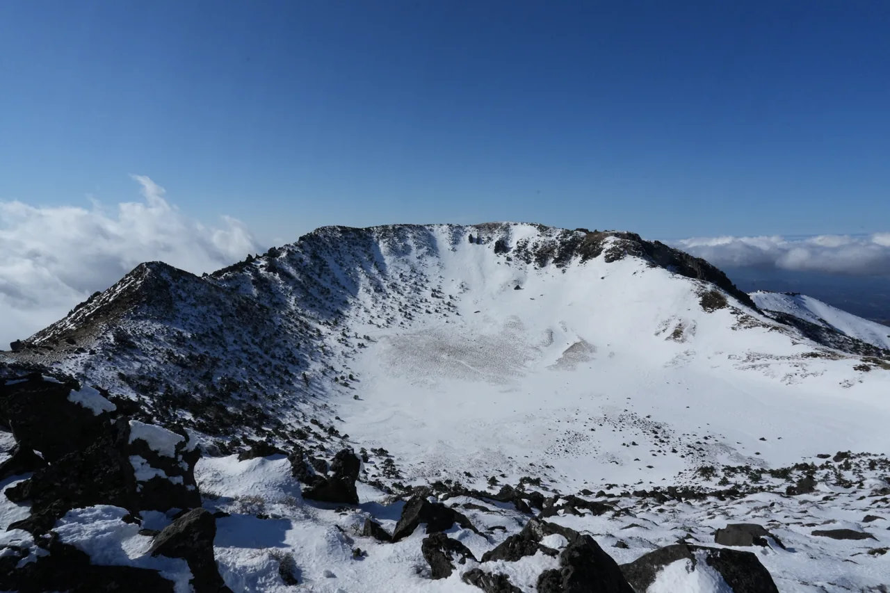
If you read that Seongpanak requires a reservation, that information is out of date. The rule now applies only to the summit. The Seongpanak trailMap is open without a permit as far as the Jindallaebat shelter at 7.3km, and the Gwaneumsa trail as far as Samgakbong at 6km. You need a booking only if you intend to stand on Baengnokdam, the summit crater.
The park hands summit permit holders a wristband at the trailhead, and the control posts at the two shelters let through only the people wearing one. The stated reason for the change was that visitors were being pushed onto the unrestricted Eosungsaeng and Yeongsil trails, crowding them instead.
Booking opens monthly
Reservations for a given month open at 09:00 on the first working day of the previous month and stay open until the end of that month. A QR code for entry and descent is sent to the phone number you register. No-shows are penalised: miss a booking without cancelling and you are blocked for three months, twice and it is a year. Cancel if your plans change.
The clock matters more than the permit
Hallasan is a same-day mountain. Entry and control times are fixed by season and enforced, so arriving late means turning back regardless of what you booked.
| Stage | Point | Jan, Feb, Nov, Dec | Mar, Apr, Sep, Oct | May~Aug |
|---|---|---|---|---|
| Entry opens | All trails | 06:00 | 05:30 | 05:00 |
| Last entry | Seongpanak / Gwaneumsa gate | 12:00 | 12:30 | 13:00 |
| Last entry | Jindallaebat / Samgakbong post | 12:00 | 12:30 | 13:00 |
| Last entry | Eoseungsaeng / Yeongsil gate | 12:00 | 14:00 | 15:00 |
| Must descend | Summit (Dongneung) | 13:30 | 14:00 | 14:30 |
| Must descend | Witseoreum | 15:00 | 16:00 | 17:00 |
Seongpanak is 9.6km one way, roughly four and a half hours up and nine hours round trip. In winter that leaves seven and a half hours between the 06:00 opening and the 13:30 summit turnaround, on snow, which halves most people’s pace. Start with the first arrivals or do not start at all.
Getting to the trailhead
Seongpanak has parking for 156 cars plus a free shuttle lot for 199 more, and both fill before dawn on peak weekends. By bus, route 281 from Jeju Bus Terminal takes about 45 minutes and runs every 10 to 14 minutes; 181 from the airport takes about 35 minutes; 182 from the World Cup Stadium about 45.
Disposable lunch boxes are banned on the mountain. Gimbap and burgers are fine. Alcohol, smoking and any open flame are prohibited under the Natural Parks Act, with fines. Camping and cooking are allowed only at the Gwaneumsa campground. Weather warnings close the trails outright, so check the national park site the night before.
8. Manjanggul reopened after 29 months
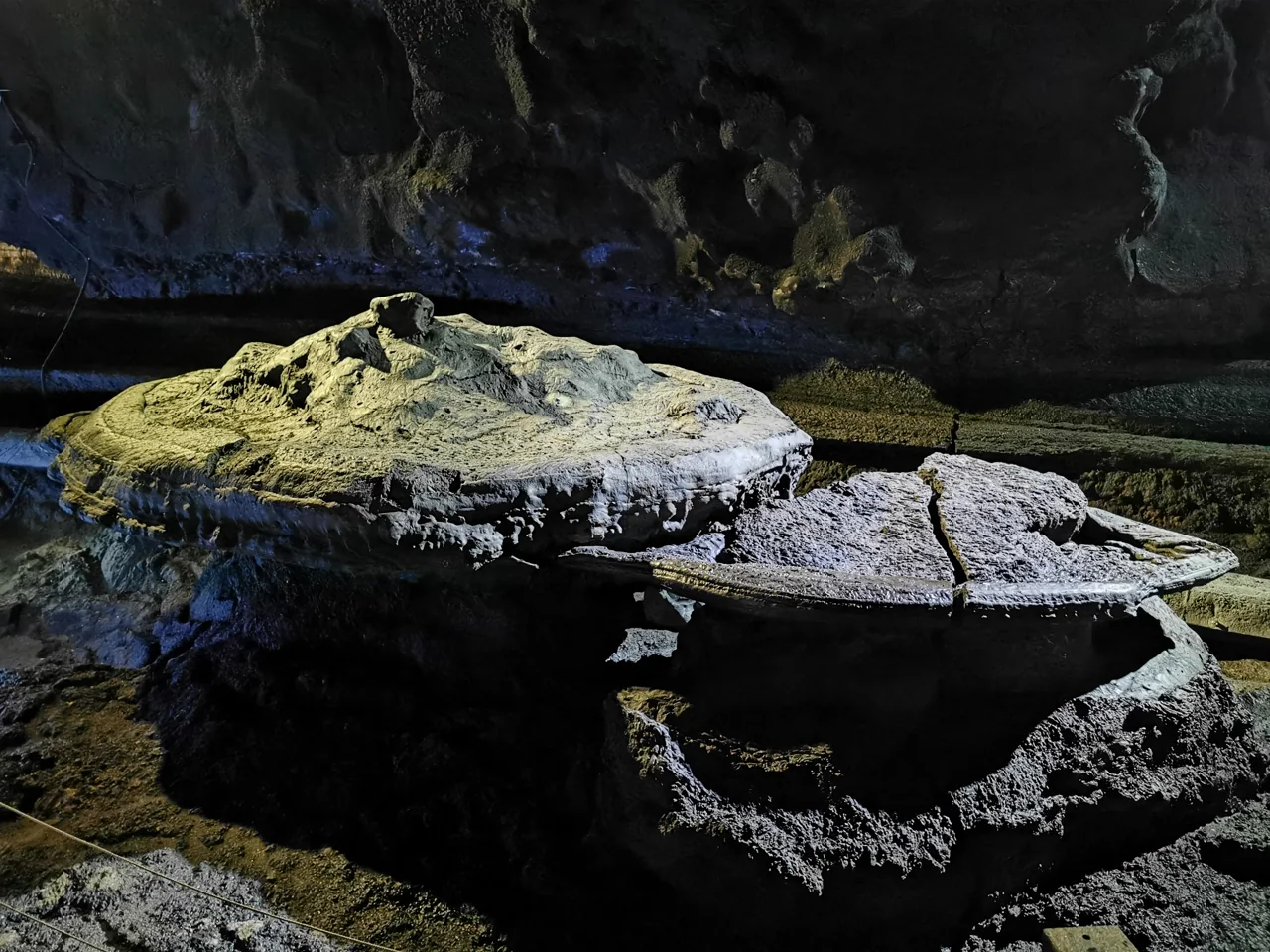
ManjanggulMap spent two years and five months closed. Rockfall near the upper part of the entrance shut it completely, and it reopened only after a full safety assessment and reinforcement programme costing 12.1 billion won. Search results still carry pages describing it as closed, and even one Jeju tourism organisation event page has not caught up.
What is different now
The one-kilometre public section has a new stainless steel walkway in place of the old timber decking, and the cave lighting has been replaced with dimmer LEDs. The lower light level is deliberate, for the cave environment, so photographs will look different from older ones you may have seen.
| Detail | |
|---|---|
| Hours | 09:00~18:00, last entry 17:00 |
| Closed | First Wednesday of each month |
| Admission | Adult 4,000 won, youth and children 2,000 won |
| Open section | About 1km of a 7.4km system |
| The thing to see | A 7.6m lava column, among the largest known |
Practicalities
The cave holds a steady cool temperature regardless of the weather outside, which makes it a magnet in August and a genuinely warm-ish stop in January. The floor is wet and uneven; wear something with grip and bring a layer. Allow an hour for the kilometre in and back.
Manjanggul belongs to the Geomunoreum lava tube system named in the UNESCO listing. Bijarim forest and Gimnyeong beach are close enough to build an east coast day around all three.
9. Seongsan Ilchulbong has a free half and a paid half
Seongsan IlchulbongMap is a tuff cone, formed when magma erupted into shallow seawater. The explosive contact threw up ash that settled in layers and hardened; the seaward face has since been cut into cliffs by the waves. It began as an island and is now joined to Jeju by a bar of sand and gravel.
You do not have to climb it
The site splits into a paid path to the summit and a free path along the Umutgae shore. The paid route is stairs and gradient for thirty to forty minutes. The free route is gentle and gives you the cone from below and from the water side, which is the angle most photographs use anyway. If you are short on time or energy, the free half is not a consolation prize.
From the top you look into a crater roughly 600m across and 214,400 square metres in area. The rim rocks look like a fortress wall, which gives the name Seongsan, “fortress mountain”; Ilchulbong means “sunrise peak”.
Opening times move with the season
| Season | Open | Last ticket |
|---|---|---|
| November~February | 06:00~18:00 | 17:00 |
| March, April, September, October | 05:00~19:00 | 18:00 |
| May~August | 04:30~20:00 | 19:00 |
The 04:30 summer opening exists for sunrise. Since the climb takes half an hour, be at the ticket office an hour before sunrise if that is what you came for. The site closes on the first Monday of every month, moving to the next day when that Monday is a public holiday. Food may not be taken in.
Two other histories on the same headland
Tunnels dug by the Japanese military during the colonial period survive around the base. The sand bar linking the cone to the main island, called Teojinmok, is a site of the Jeju 4·3 events described later on this page. Neither is signposted prominently, and both are worth two minutes of reading before you walk past them.
Haenyeo at the foot of the cone
At the Umutgae shore below, Jeju’s women divers work at certain times. This is not a scheduled performance; it depends on tide and weather. Their diving culture was inscribed by UNESCO as intangible cultural heritage in 2016.
10. Udo, Mara and Gapa: three boats, three sets of rules
Three offshore islands are realistic day trips, each from a different port and each with its own conditions.
Udo will not let your rental car on
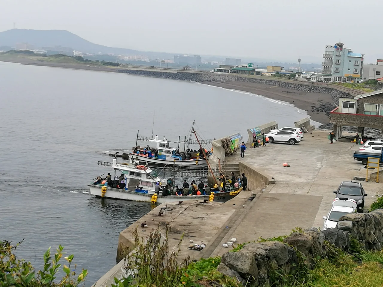
Boats leave Seongsan PortMap and Jongdal Port for Cheonjin and Haumokdong on UdoMap, about ten minutes across. Ordinary rental cars are barred from the island. The exceptions are vehicles belonging to people staying overnight and those carrying passengers with reduced mobility, plus a temporary allowance for electric and hydrogen rental cars and chartered buses of 16 seats or fewer.
So you circulate by electric bike, scooter or the island loop bus. On foot, Olle route 1-1 goes right round the coast in four to five hours. The village bus fare on Udo is 950 won.
Return tickets are same-day only. If you are staying the night on Udo, buy one-way and buy again coming back. Miss the last boat and you are sleeping there.
Mara and Gapa leave from Unjin Port
Both sail from Unjin PortMap at Moseulpo on the south-west coast, with a second operator running from Sanisudong. Fares combine the boat with a marine park entry charge.
| Passenger | Mara, return | Gapa, return |
|---|---|---|
| Adult | 21,000 won | 15,500 won |
| Middle and high school | 20,800 won | 15,300 won |
| Child (24 months to primary) | 10,500 won | 7,800 won |
| Over 65 | 16,000 won | 11,600 won |
| Infant under 24 months | Free | Free |
Two things catch people out. A fuel surcharge is charged separately at the terminal and by bank transfer only, with no exemptions and the same amount for adults and children. And boarding requires a completed embarkation form plus original photo identification for every adult in the party. Photographs of documents are not accepted, so carry your passport.
Gapa is flat, low and known for barley fields in spring; a full circuit takes about two hours on foot. Mara is the southernmost point of South Korea, small, and improbably full of jajangmyeon restaurants. Sailing times mean you typically get ninety minutes to two hours ashore on either.
11. The south coast stacks waterfalls close together
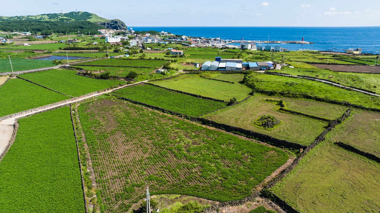
Between Seogwipo town and Jungmun, within a few kilometres, sit three waterfalls, a columnar basalt cliff and the resort strip. From a northern base each of these is a day trip. From a southern base you can see three of them before lunch. This is the strongest practical argument for sleeping in the south.
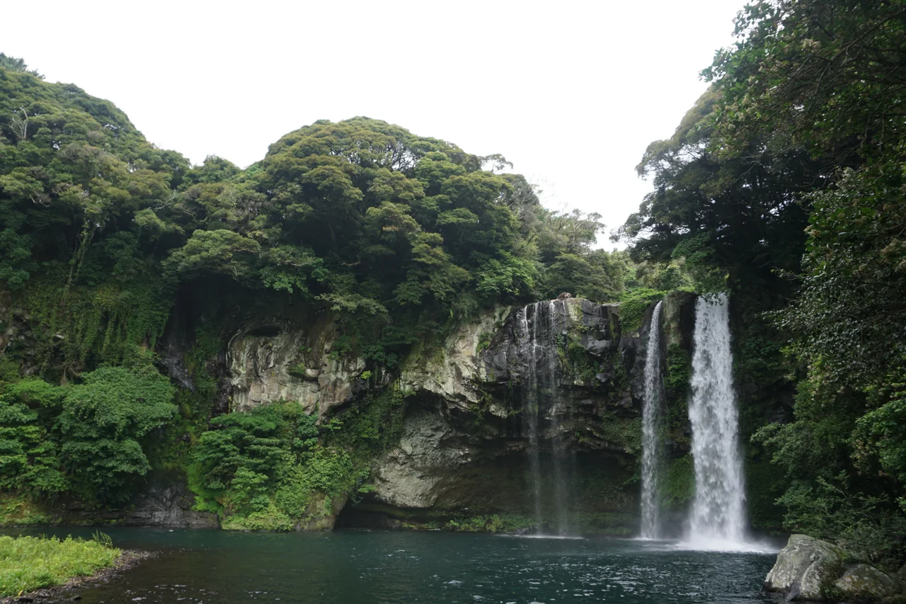
Three waterfalls, three different walks
| Waterfall | What it is | Effort |
|---|---|---|
| Cheonjiyeon | Close to Seogwipo town, lit at night | Flat path |
| Jeongbang | Falls directly into the sea | Many steps down and back |
| Cheonjeyeon | At Jungmun, three tiers linked by bridges | Bridges and stairs |
CheonjiyeonMap is the accessible one: level ground from the car park, which makes it the choice with older relatives or a pushchair. Jeongbang is the dramatic one and the hardest on knees. All three are free to Nowda members and 2,000 to 2,500 won otherwise.
The columnar cliffs
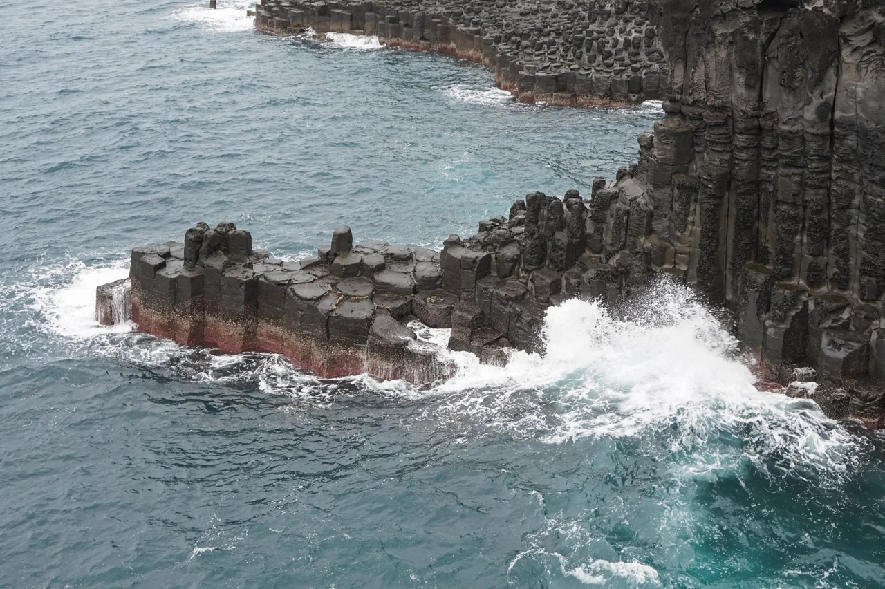
JusangjeolliMap is a wall of hexagonal basalt columns formed as lava cooled, viewed from a walkway above. It is worth timing for a day with some swell, since the point of it is the water breaking against the columns. Half an hour covers the whole viewing route.
Jungmun and Seogwipo town
Jungmun is the resort cluster: international hotels, a convention centre and a beach, with the waterfalls and cliffs within a short drive. Dinner inside the complex is priced for hotel guests, and the more interesting eating is back in Seogwipo town. Airport limousine 600 runs in via the convention centre.
Seogwipo town itself is small enough to walk. Seogwipo Maeil Olle Market runs through the middle of it and stays open into the evening. The house where the painter Lee Jung-seop lived as a refugee, and the museum attached to it, are a few minutes away.
12. The west is a coastal road and a sunset
The west coast is where the road runs closest to the water. From Aewol through to Hallim, cafés line a route with limited places to stop, and on weekend afternoons those few pull-ins are the bottleneck for the whole drive. Early morning or late afternoon is a different experience entirely.
Hyeopjae and Geumneung
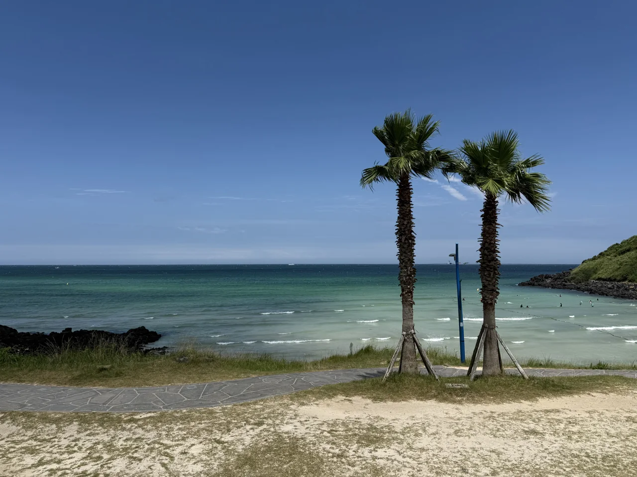
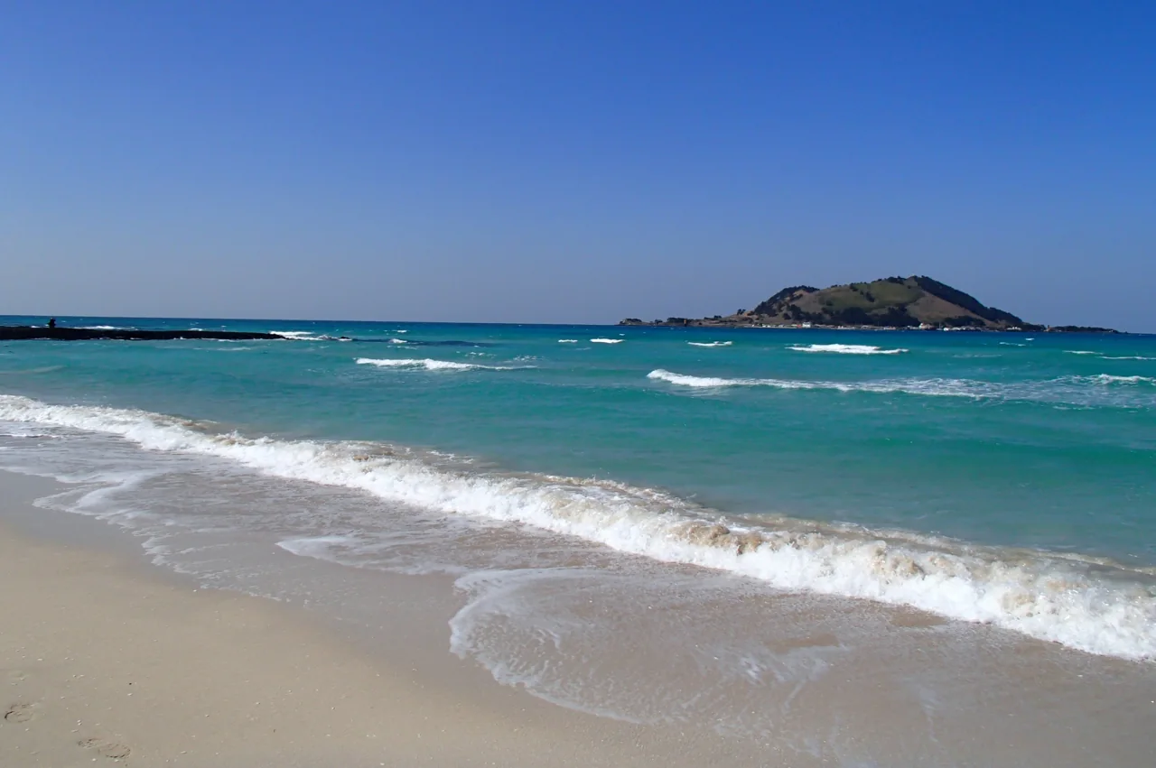
HyeopjaeMap is the pale-water beach in the photographs, with the small cone of Biyangdo sitting offshore in almost every frame. Geumneung, immediately next door, is the same shoreline with fewer people. At low tide the walkable sand extends a long way out.
Because the sun sets over the sea on this coast, the west fills up again at dusk: around 19:30 in summer, 17:30 in winter. Check the day’s sunset time and be in position half an hour early.
Sanbangsan and Yongmeori
Further south-west, SanbangsanMap rises abruptly out of flat farmland as a lava dome. Below it, the Yongmeori coast is a set of layered sedimentary shelves running down to the waterline.
Yongmeori closes often. The path sits at sea level, so high tide or any real swell shuts it, and you generally find out on arrival. Plan it together with Sanbangsan and treat entry as a bonus rather than the reason for the trip.
The west without a car
Express 102 and trunk route 202 run the west coast road from Jeju Bus Terminal through Hallim and Gosan towards Seogwipo. The café stretch requires walking in from the stops, so a realistic bus day out here is two beaches and Sanbangsan.
13. The east is forest and cinder cones
The east coast is known for beaches and the lava tube, but the interior behind them is forest. That matters in August, when the coast is hot, and in January, when it is windy.
Bijarim
BijarimMap is a stand of old nutmeg yews with a flat, well-surfaced path, parts of it usable with a wheelchair or pushchair. A circuit takes under an hour, and the canopy drops the temperature noticeably on a hot day. It is fifteen minutes by car from Manjanggul, which makes the two an obvious pair.
Saryeoni Forest Path
Saryeoni runs through the mid-slope forest in the centre of the island, mostly level, with long avenues of cedar. Walking the whole thing takes most of a day, so many people walk in from one entrance and turn back. Mist forms here regularly, and it stays cool even in midsummer.
If you climb one oreum
| Oreum | Where | Climb | What you get |
|---|---|---|---|
| Saebyeol | Aewol, west | 20~30 min, steep in places | Autumn silver grass, western plain |
| Darangshi | Gujwa, east | 30~40 min of steps | A deep crater, the eastern cones |
| Sangumburi | Jocheon, centre | 10 min, nearly level | A broad crater and grassland |
| Ttarabi | Pyoseon, south-east | 20~30 min | Overlapping ridgelines |
Go early or late. There is no shade on an oreum, and the grass only takes on colour when the light is low. Wear something with a stiff sole; the compacted volcanic soil is slick after rain.
Some oreum are private land or on rest rotation. Popular ones get closed for years at a time to let the surface recover, and access can change without much warning. If a specific cone is the point of your day, check that it is open the evening before.
14. The Olle trail is 27 routes and 437km
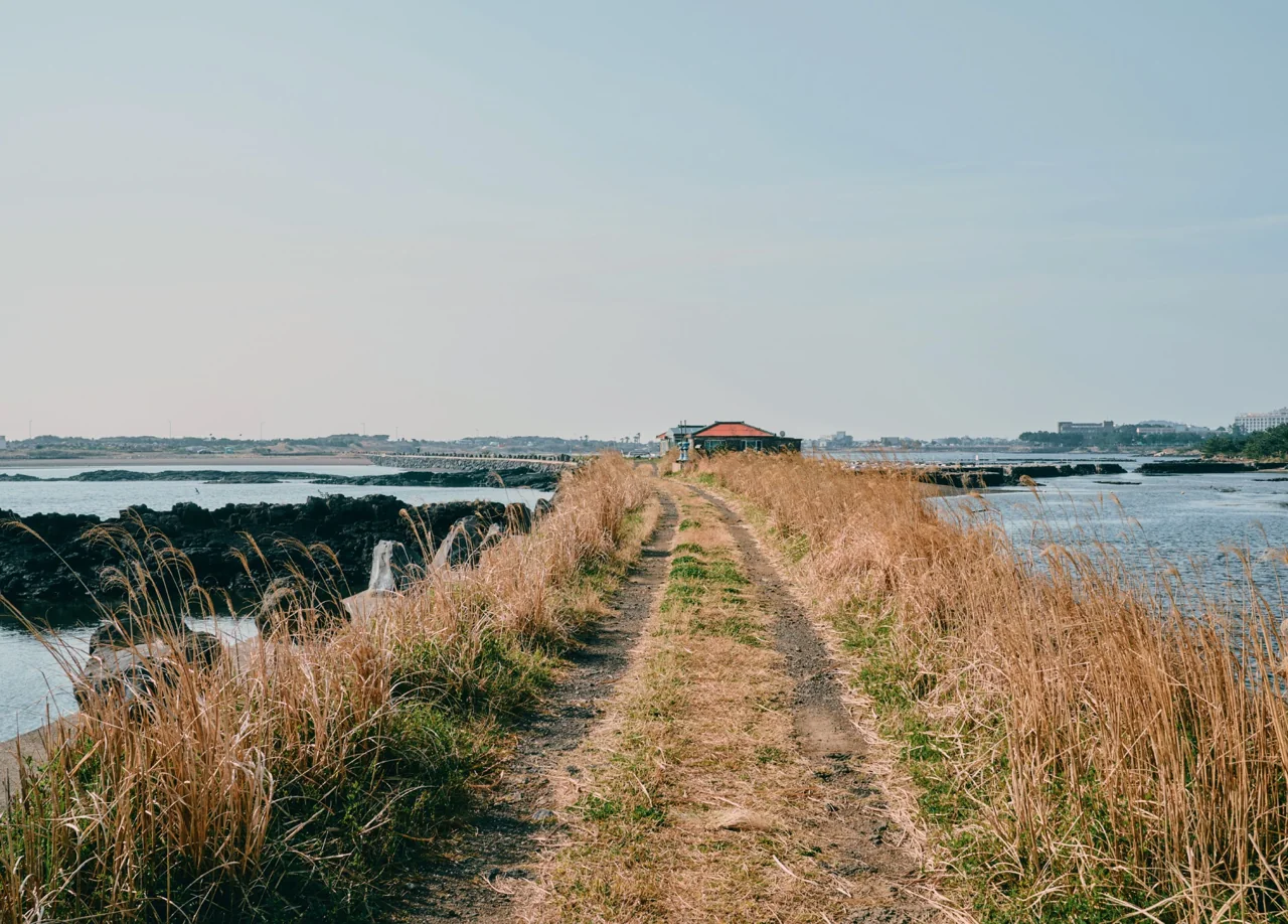
Jeju Olle is a walking network that circles the island. The first route opened in 2007 and the loop was completed with route 21 in 2012. Counting the lettered variants, there are 27 routes totalling 437km: 1 through 21 plus 1-1, 7-1, 10-1, 14-1, 18-1 and 18-2.
One route is one day
Routes run roughly 13 to 20km, or four to six hours at an unhurried pace. If you are fitting one into a general trip, choose it by whether buses serve both ends rather than by scenery, because the taxi back from a rural finish is the expensive part of the day.
| Route | Section | Good if |
|---|---|---|
| 1 | Siheung to Gwangchigi beach, east | You are based near Seongsan |
| 1-1 | The circuit of Udo | You are giving Udo a full day |
| 6 | Soesokkak to Seogwipo town | You are in the south and want an urban finish |
| 7 | Seogwipo to Wolpyeong, coastal | You want the sea in view throughout |
| 10 | Hwasun to Moseulpo, past Sanbangsan | You are in the south-west |
Passport, stamps and the Global Olle Pass
Walkers buy an Olle passport and collect stamps at the start, middle and end of each route, exchanging a completed book for a certificate at the Olle Traveller Centre in Seogwipo. The foundation also issues a Global Olle Pass aimed at international walkers, which is the version worth asking about if you do not read Korean.
Check for detours before you set off. Sections are rerouted for construction or safety fairly often; route 7 was changed around Beophwan harbour and route 17 has carried a diversion. Stamp locations sometimes move with them, so read the official notices the night before.
Waymarking is blue and orange ribbons tied to trees and poles, arrows painted on stone, and a small horse-shaped marker called ganse. The ribbon order tells you which direction you are walking. If the ribbons stop appearing, backtrack to the last one rather than guessing forward.
15. The haenyeo, and Jeju 4·3
Volcanic landscape and beaches are the surface of this island. Two other things shaped what you will actually be looking at.
The haenyeo
Haenyeo are women who free-dive without breathing apparatus to harvest shellfish and seaweed. UNESCO inscribed Jeju haenyeo culture as intangible cultural heritage in 2016, and the citation covers not only the diving but the way the work is organised: fishing grounds and seasons allocated by village, and position in the water set by seniority and skill.
Numbers have fallen sharply and the remaining divers are mostly elderly. If you see divers coming out of the water at a beach, think before raising a camera. This is their workplace, not a display. The Haenyeo MuseumMap in Gujwa covers the history properly.
Jeju 4·3
Around 1948, a large number of islanders were killed in events now referred to as Jeju 4·3. Entire villages disappeared, and markers reading “lost village” still stand where some of them were. The sand bar at Seongsan Ilchulbong is one of the associated sites.
The Jeju 4·3 Peace ParkMap at Bonggae-dong in Jeju City documents it. Entry is free, hours are 09:00 to 18:00 with last admission at 17:00, and it closes on the first and third Monday of each month, moving to the next non-holiday weekday where those fall on a public holiday. Food and pets other than guide dogs are not permitted inside.
Allow an hour and a half to two hours. The exhibition is heavy going, and most people find they do not want a tightly scheduled stop immediately afterwards. English labelling is present throughout the main exhibition.
16. What to eat
Jeju cooking is built on what the island has: pork, fish, seaweed and citrus, usually in a bowl of something hot.
| Dish | What it is | Best in |
|---|---|---|
| Heukdwaeji gui | Black pork, grilled in thick cuts | Any month |
| Gogi guksu | Wheat noodles in pork broth with sliced pork | Any month |
| Momguk | Gulfweed and pork broth soup | Winter |
| Jari mulhoe | Chilled raw damselfish soup with soybean paste | Summer |
| Galchi | Beltfish, braised or grilled | Autumn |
| Haemul ttukbaegi | Abalone, clams and crab in an earthenware pot | Any month |
| Bomal kalguksu | Knife-cut noodles with ground sea snail | Any month |
Citrus has a season
Open-field mandarins are harvested from late autumn into early winter, which is when the picking farms around Seogwipo and Namwon open to visitors. Hallabong and cheonhyehyang come slightly later, through winter into early spring. Outside those windows you are buying stored or greenhouse fruit, and it tastes like it.
Ask the price first
Beltfish, tilefish and abalone are priced by size, and menus often say “market price” rather than a number. Asking before you order is normal and not rude. Restaurants a street back from the attractions are consistently cheaper than the ones facing them. Our Korean food guide covers the national dishes you will also find here.
Two things to buy at a market: omegi tteok, a rice cake rolled thickly in red bean, and bingtteok, a buckwheat crêpe wrapped around seasoned radish and deliberately plain. Both are best the day you buy them.
17. Where to go when it rains
It rains on about 128 days a year in the north of the island. Over a three-day stay the arithmetic says you will meet one of them. Having one or two indoor options already chosen is the difference between a lost day and a rearranged one.
| Place | Where | Time needed | Admission |
|---|---|---|---|
| Manjanggul | Gujwa, east | 1 hour | 4,000 won |
| Jeju 4·3 Peace Park | Bonggae, north | 1.5~2 hours | Free |
| Folklore and Natural History Museum | Jeju City | 1 hour | Low, half price for members |
| Haenyeo Museum | Gujwa, east | 1 hour | Low |
| Lee Jung-seop Art Museum | Seogwipo town | 40 min~1 hour | Low |
| Jeju Museum of Art | West of Jeju City | 1 hour | Low |
Some things are better wet
Waterfalls run thin in dry spells and thicken noticeably the day after rain, so Cheonjiyeon and Jeongbang reward bad weather. Bijarim and Saryeoni also look better wet, though the paths get slippery.
Some things simply stop
The Hallasan summit closes under weather warnings. Ferries to Udo, Mara and Gapa cancel on high seas warnings. The Yongmeori coastal path shuts on swell. None of these four has an indoor substitute, so put them early in the trip and keep a spare day behind them. Booking the boat for your last morning is how people end up not going at all.
18. What a day costs
The airfare and the car move the daily total on Jeju more than anything else, and both swing by season rather than by choice of hotel.
| Item | Lean | Middle | Comfortable |
|---|---|---|---|
| Transport | Buses, 3,000~6,000 won a person | Car, 30,000~50,000 won off season | Car, 100,000~200,000 won at peak |
| Room for two | Guesthouse or motel | City hotel | Jungmun resort |
| Admissions | Free paths and free sites | 10,000~15,000 won a person | 20,000 won and up |
| Food for two | Noodles and set meals | One black pork dinner | Seafood and beltfish courses |
The car is the variable
A compact at 20,000 to 30,000 won a day off season and 200,000 at peak means the same three-day rental is 60,000 won or 600,000 won depending on when you go. Price the car before you price anything else. Fuel and parking add less than you would expect, since parking is free at most attractions.
Admissions are modest
Seongsan Ilchulbong at 5,000 won and Manjanggul at 4,000 won are the two highest on most itineraries, and the waterfalls are 2,000 to 2,500 won each. Two or three sites a day is around 10,000 won a person. As a visitor you cannot use the local membership discount described earlier, so budget the list price.
Boats add up faster
Mara is 21,000 won return, Gapa 15,500 won, with the fuel surcharge on top and payable at the terminal. Add Udo and a two-island day passes 30,000 won a person before you have eaten. Worth deciding in advance rather than at the ticket window.
Domestic fares follow the day of the week. Friday evening and Sunday afternoon are the expensive slots in both directions. Shifting either end of the trip by a day frequently costs less than the airport transfer you saved.
19. When to come
You can visit Jeju in any month, but the month decides what you are looking at. Reading the climate normals by season gives this.
| Period | Weather | What is happening | Watch for |
|---|---|---|---|
| March~April | 10~15°C, wind easing | Rapeseed flowers, cherry blossom, Gapa barley | Southern rain climbs from April |
| May~June | 18~22°C | Hydrangeas, new growth | Seogwipo gets double the north’s rain |
| July~August | 26~27°C, 30 tropical nights | Swimming, cave-cooling | Wettest and most expensive |
| September~October | 18~23°C | Silver grass, walking weather | Fewest wet days all year |
| November~December | 8~13°C | Citrus harvest, clear skies | December is the driest month |
| January~February | 6~8°C, wind 4.1m/s | Camellias, snow on Hallasan | Highest cancellation risk |
October is the safe answer
Wet days fall to 6.7 in the north and 5.8 in the south, the lowest of the year, at 18 to 19°C. Silver grass covers the oreum. Summer peak pricing on flights and rental cars has ended. Nothing else in the calendar lines up as well.
Summer is wetter in the south
August brings 272mm to Jeju City, 316mm to Seogwipo and more again at Seongsan, with 16.6 tropical nights in the north. If those are your dates, plan half your days indoors from the start: the lava tube, the museums, the galleries. That is what they are for in August.
Winter belongs to the south, unless you climb
Seogwipo runs 1.1°C warmer in January with half the wind and half the snow days. The exception is anyone here for Hallasan under snow, where the northern trailheads are easier to reach. Either way, build slack into the day you fly home.
20. How many days
Jeju absorbs anything from two nights to a week. What changes is not how much you see but how much you have to leave out.
Two nights: pick a side
East or west, not both. East gives you Seongsan Ilchulbong, Udo, Manjanggul, Bijarim and a beach at Hamdeok or Woljeong. West gives you Hyeopjae and Geumneung, the Aewol coastal road, Sanbangsan and Yongmeori. Combining them spends the middle day in the car.
Three nights: split north and south
Two nights in the north covering one direction, then move to Seogwipo for waterfalls, Jungmun and a southern Olle route. This is the shortest trip that can include Hallasan, because the summit is a nine-hour round trip and eats the whole day it falls on.
Four nights or more: islands and cones
Add Mara or Gapa, put two or three oreum into early mornings, walk more than one Olle route. At this length a rained-out day can simply be swapped with another rather than lost.
| Length | Bases | Fits | Leave out |
|---|---|---|---|
| 2 nights | One | Three or four sights in one direction | Hallasan, the islets |
| 3 nights | North + south | Hallasan or one islet | Both together |
| 4+ nights | Two or three | Hallasan, islets, several Olle routes | Nothing much |
Combining Jeju with the mainland
Jeju connects to the rest of Korea only by air, so every combination costs a transfer at both ends. Seoul is the usual pairing, and there are direct flights from Busan, Daegu and Gwangju as well. See our Seoul travel guide and Busan travel guide, or Gangneung if you want the east coast in the same trip. Our Korea itineraries put the whole thing in order.
You pay nothing to enter Jeju. A proposed environmental levy, often called an island entry tax in English coverage, was debated at length and shelved. There is no arrival charge of any kind.
🚇Getting Around2
🧭All-Korea essentials136
Jeju travel: frequently asked questions
See the full Korea travel guide
Images: Photographs via Wikimedia Commons: Bernard Gagnon (CC0), Hong Da Hyeon (CC0), Sadopaul (CC BY 4.0), AhmadElq (CC BY-SA 4.0), Lcarrion88 (CC BY-SA 4.0), Yhnn0065 (CC BY-SA 3.0), Jeju Film Commission / KOGL Type 1, Jeju Olle Foundation (CC BY-SA 4.0), Teemeah (CC BY-SA 4.0).