There is a 4.7km stretch of undeveloped sea cliff inside Busan. This page is part of our complete Busan travel guide.
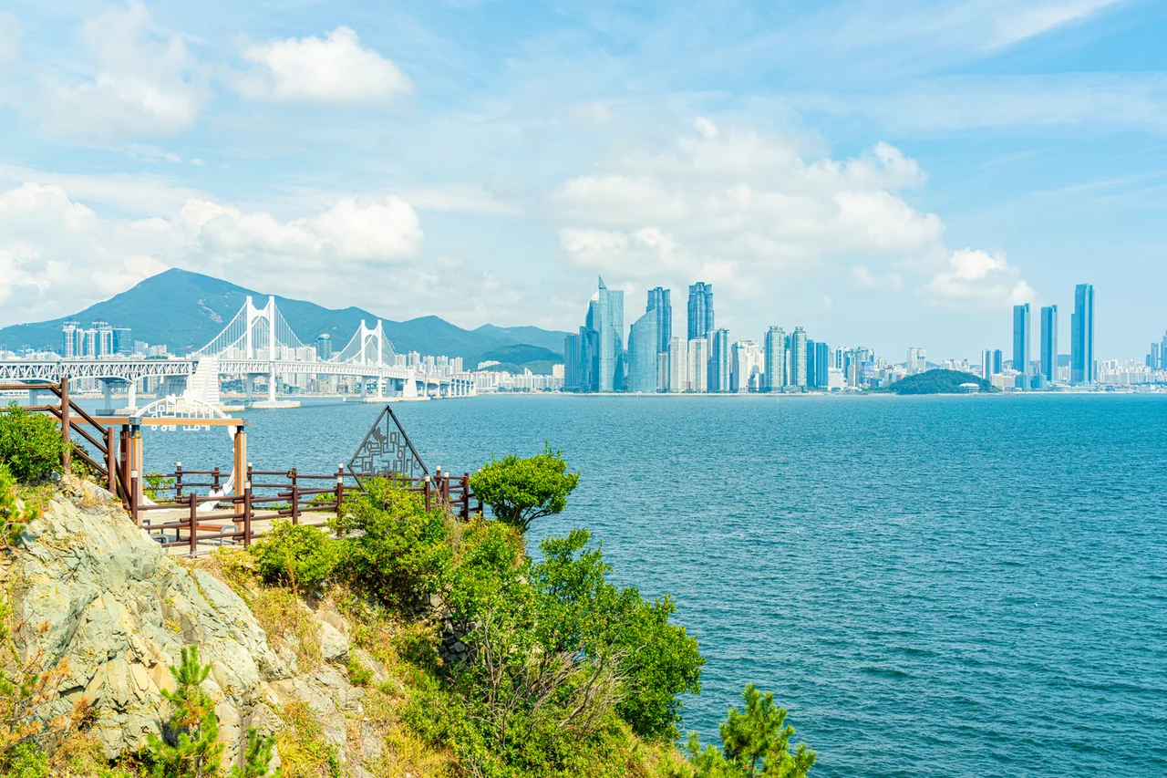
The Gwangan Bridge and Marine City from the Igidae trail. Photo: Hyphen Group / Busan Tourism Organization, KOGL Type 1.
1. The city and the sea in the same frame
The Igidae📍Map coastal trail runs 4.7km from Dongsaengmal to Oryukdo Sunrise Park. The Busan Tourism Organization puts it at about two and a half hours, and nothing along it costs money.
What makes it unusual is the split view. On one side there is cliff and surf. On the other, across the water, you get Gwangalli, the Gwangan Bridge and the Marine City towers of Haeundae at the same time. This is not a walk that takes you away from the city. It is a walk that keeps the city in the corner of your eye for two hours.
Detail
Distance
4.7km, Dongsaengmal to Oryukdo Sunrise Park
Time
About 2 hours 30 minutes (Busan Tourism Organization)
Cost
Free, open year round
What it is
Section 2 of the Galmaetgil network and a Busan National Geopark site
Suspension bridge
127m, made of five short spans linked together
Skywalk enquiries
Nam-gu facilities agency, 051-601-3416
You will also see 3.95km and two hours quoted. That is the geopark’s figure and it measures from Eoulmadang rather than Dongsaengmal. Add the first section back and you get 4.7km.
🏨 The northern end of the trail sits right beside Gwangalli, so a room there puts dinner at the finish lineSee on Trip.com →See on Agoda →See on Expedia →Affiliate link — we may earn a commission at no extra cost to you.
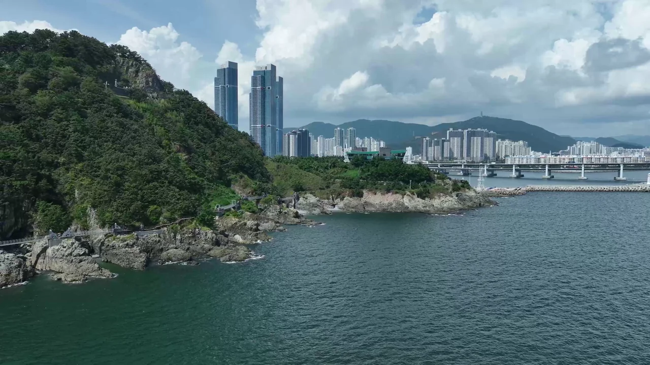
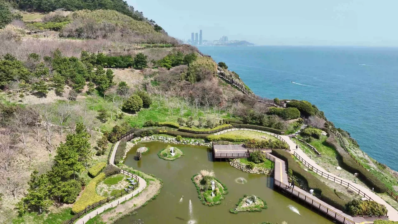
The Igidae coast, with the boardwalk following the cliff line. Photo: Hyphen Group / Busan Tourism Organization, KOGL Type 1.
2. Which end you start from changes everything
Same path, but the direction changes four things: your deadline, how you arrive, where you end up, and what is in front of you while you walk.
Starting at Oryukdo
Starting at Dongsaengmal
Skywalk
Done first. Closing time stops mattering
You have to arrive before it shuts
Getting there
City buses 24, 27 and 131, end of the line
Village bus Nam-gu 2, or walk up
Where you finish
Dongsaengmal, next to Gwangalli
Oryukdo, then back out by bus
What you see
The city grows in front of you
Sea and islands take over the view
The skywalk’s hours decide your direction. It opens at 09:00 and closes at 19:00 from June to September, 18:00 from October to May, with last entry ten minutes before closing. On Lunar New Year and Chuseok it opens at noon. If you set off from Dongsaengmal and the walk takes two and a half hours, do the arithmetic before you start.
Winter adds a second catch. The Nam-gu 2 village bus, the one that climbs to Dongsaengmal, only runs from April to December. Between January and March you are walking up from a city bus stop or taking a taxi. At weekends and on public holidays that same bus loops between the Oryukdo jetty, the Haeparang trail office, the Keungogae rest stop, the Igidae park car park and the Dongsaengmal entrance.
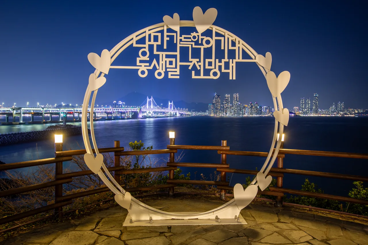
If the night view is the point, there is only one answer: start at Oryukdo and finish at Dongsaengmal. The spot where the Gwangan Bridge lights up straight ahead of you is at that end.
Dongsaengmal takes the Gwangan Bridge head on. Photo: Summertree and Jeong Min-gyu / Busan Metropolitan City, KOGL Type 1.
3. Starting from the glass skywalk
The Oryukdo Skywalk📍Map is a 15m glass walkway cantilevered 35m above the cliff. The floor is transparent, so the surf breaking underneath is part of the experience. It is free.
The city says it draws more than a million visits a year. For a free installation it is well kept, and on a clear day you can pick out Tsushima, the Japanese island, on the horizon. Busan signs this point as the boundary between the East Sea and the South Sea.
Two long-distance trails meet here. Oryukdo Sunrise Park is the start of the 770km Haeparang Trail up the east coast and the end of the 1,463km Namparang Trail along the south coast. That is why there is usually a queue of people photographing the marker.
The car park and the information office are on this side. So are toilets, along with the ones at the far end; the middle of the route has almost none. Buy water before you set off, because nothing is sold along the trail.
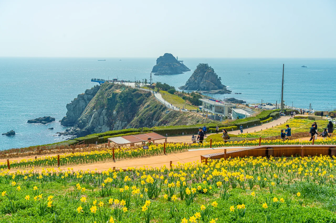
Oryukdo Sunrise Park in spring. The daffodils are seasonal. Photo: Hyphen Group / Busan Tourism Organization, KOGL Type 1.
4. Oryukdo is five islands and also six
The name records the fact that, depending on the tide and your angle, you count five or you count six.Oryukdo📍Map was designated Scenic Site No. 24 on 1 October 2007. It covers 28,189 square metres and is managed by Nam-gu district.
Working outward from the shore, each rock has a name.
Island
Where the name comes from
Bangpaeseom
Shaped like a shield, taking the wind and swell
Solseom
A pine grows on top. With Bangpaeseom it forms Usakdo
Suriseom
Eagles and kites gathered here to hunt gulls
Songgotseom
It comes to a point
Gulseom
There is a cave through the middle
Deungdaeseom
It carries the lighthouse
Six names, but the place is called five-or-six because Bangpaeseom and Solseom sit against each other. A high tide floods the gap and they read as one rock; a low tide splits them in two. Count from the same spot morning and evening and you get different answers.
Oryukdo Sunrise Park, where the car park and information office are. Photo: Hyphen Group / Busan Tourism Organization, KOGL Type 1.
5. Why this cliff is still empty
Not conservation. Access control. Igidae was a military operations zone for decades and civilians could not enter it.
1993. Civilian access is permitted. Until then this was a coastline that existed on the map and nowhere else.
1997. It is designated a park to protect the landscape.
2005. Work on the walking trail begins.
2009. The Galmaetgil programme upgrades it into the route people walk today.
While Gwangalli and Haeundae filled up with towers, this stretch stayed as it was. Development did not spare it; development could not get in. Apart from the cliffs on Yeongdo island, no comparable length of natural coast survives inside the city.
The name is far older. Igidae means the terrace of the two courtesans, and is linked to a story from the Japanese invasions of the 1590s in which two women went into the sea from these rocks. The geopark itself notes that the origin is not confirmed.
6. You are walking on an 80-million-year-old volcano
Igidae and Oryukdo are geosites within the Busan National Geopark. According to the geopark, the rock here formed around 80 million years ago at the end of the Cretaceous, from lava, ash and pyroclastic flows that settled into volcanic rock and tuffaceous sediment.
You do not need a geology degree to spot the results.
Cliffs and shore platforms
The vertical face the waves have cut, and the flat rock shelf left below it. Much of the trail runs along the top.
Potholes
Round hollows drilled by a pebble spinning in a depression for centuries. They come in every size.
Dykes
Bands of magma that pushed up through older rock and cooled inside it. They read as stripes of a different colour.
There are human traces too. Remains of a colonial-era copper mine sit near the water, and between Dongsaengmal and Eoulmadang you pass low stone mounds that were shelters for haenyeo divers, used to store gear and rest between dives.
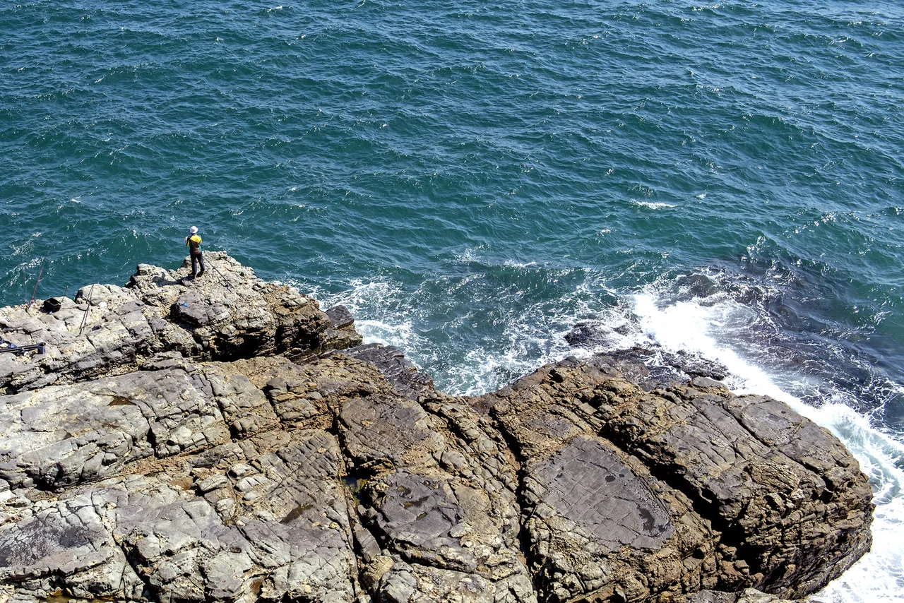
The layered rock along the shore. Waves reach these ledges. Photo: Summertree and Ieum Media / Busan Tourism Organization, KOGL Type 1.
7. The suspension bridge, Eoulmadang and Nongbawi
The places people stop are more or less fixed.
The suspension bridge
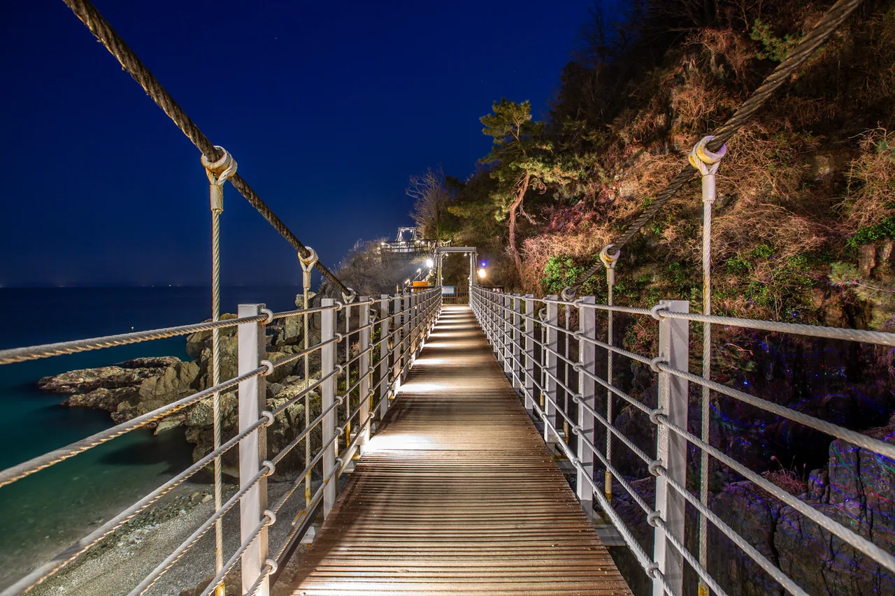
It is 127m long, and it is not one span. It is five short suspension bridges linked end to end, so the deck gives slightly under each step. Rock and water sit below. High railings and a timber deck make it safe enough, but if heights bother you, budget extra time here.
Eoulmadang
An open platform facing the water, used as a location for the Korean disaster film Haeundae. From here the Gwangan Bridge, Haeundae beach and the Nurimaru pavilion line up in a single frame, which is why this is the spot people name when they ask about photo spots in Busan within Igidae.
Chimabawi and Nongbawi
Chimabawi is named for its resemblance to a folded hanbok skirt. Nongbawi looks like stacked traditional chests and served as a navigation marker for haenyeo divers who came up from Jeju to work this coast. A rock name that records how people made a living here.
The suspension bridge: five short spans adding up to 127 metres. Photo: Summertree and Jeong Min-gyu / Busan Metropolitan City, KOGL Type 1.
8. Finish at Dongsaengmal and the city switches on
The last half hour can be the best part of the day. After sunset the Gwangan Bridge📍Map lights up and the Marine City towers come on one by one. The place that takes all of that head on is Dongsaengmal📍Map.
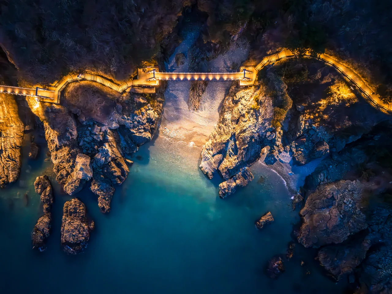
It needs planning, though. Parts of the trail have no continuous lighting, and the bridge and stair sections slow right down in the dark. Aim to be past the suspension bridge an hour before sunset. Carry a torch, or at least a charged phone.
From Dongsaengmal it is a short drop to Gwangalli beach, which makes dinner and a night out in Busan a natural continuation. Finishing at Oryukdo instead means backtracking from a bus terminus, and that end of the trail has little open after dark.
🎟️ If you want the night views without the four kilometres, evening tours cover the Gwangan Bridge and Haeundae in one runSee on Klook →See on Viator →See on KKday →See on Trip.com →Affiliate link — we may earn a commission at no extra cost to you.
The suspension bridge from directly above at night. Photo: Summertree and Jeong Min-gyu / Busan Metropolitan City, KOGL Type 1.
9. How hard it actually is
This is not a flat promenade. Following a cliff line means continuous climbing and dropping, with staircases spread through the route. No single climb is long, but you are going up and down for two and a half hours.
Aspect
What to expect
Surface
Timber boardwalk, packed earth and rock sections
Stairs
Several flights. Slippery when wet
Pushchair or wheelchair
Not viable end to end. The Oryukdo park area is adapted
Toilets
At both ends. Assume none in between
Food and drink
Nothing is sold on the trail. Bring water
Footwear
Trainers at minimum. No sandals, no heels
If the full route is too much, half works well. Oryukdo to Nongbawi and back, or Dongsaengmal to Eoulmadang and back, each take about an hour. Among things to do in Busan that involve effort, this sits in the middle.
10. When to walk it
Every season has its own catch. Busan being mild year round does not make the months interchangeable.
Season
What to weigh up
Spring
Daffodils out at Oryukdo park, and the best walking temperatures of the year
Summer
Very little shade. Skip the middle of the day and start late afternoon
Autumn
Clearer air, so more days when Tsushima is visible
Winter
Strong wind, plus the Nam-gu 2 village bus stops running from January to March
By time of day there are two choices. For sunrise, Oryukdo: the park is named for it and faces due east. For the night view, Dongsaengmal. Doing both in one day means two separate trips out, before dawn and again at dusk. Month by month conditions are in the best time to visit Busan.
Rain is not worth it here. Rock and stairs get slippery, and on a cliff walk with no visibility there is not much left.
11. The danger is off the trail, not on it
The path itself is safe. Incidents happen when people leave it. This coast is a known fishing spot and some visitors climb down from the boardwalk onto the rocks.
Those rocks take waves. Calm conditions still produce the occasional large set, wet rock with algae on it is extremely slippery, and the terrain is bad for a rescue. Do not cross the railing for a photograph.
The rest is simple. Where signage closes a section, it is closed for a reason, and the suspension bridge section can be shut in typhoon or high wind warnings. Carry plenty of water in summer, and avoid walking alone after dark.
Staying near Busan Station puts this about 40 minutes away. For a short outing straight off the train, Choryang Ibagu-gil is the closer option; this route wants half a day cleared for it. Bus numbers change when the city reorganises routes, so check them along with your Busan transit card before you set out. For fitting it into a wider plan, see things to do in Busan.
🏨 If you would rather look back at this cliff from across the bay, the Marine City side works too. Different angle, same waterSee on Trip.com →See on Agoda →See on Expedia →Affiliate link — we may earn a commission at no extra cost to you.
It is 4.7km from Dongsaengmal to Oryukdo Sunrise Park, and the Busan Tourism Organization allows about two and a half hours. Stopping for photographs pushes it past three. Half the route and back is around an hour.
Q. Is there an entry fee for the Oryukdo Skywalk?
No. Both the coastal trail and the glass skywalk are free.
Q. What time does the skywalk close?
19:00 from June to September and 18:00 from October to May, opening at 09:00, with last entry ten minutes before closing. On Lunar New Year and Chuseok it opens at noon instead.
Q. Which direction should I walk?
For the night view, start at Oryukdo and finish at Dongsaengmal, where the Gwangan Bridge lights up in front of you. If the skywalk or sunrise is your priority, do Oryukdo first so closing time never becomes a problem.
Q. How do I get there?
For the Oryukdo end, take metro line 2 to Kyungsung University station and then city bus 24, 27 or 131 to the last stop, Oryukdo Skywalk. For Dongsaengmal, the Nam-gu 2 village bus runs April to December only. Bus numbering changes with route reshuffles, so check before you travel.
Q. Is it accessible with a wheelchair or pushchair?
Not the full route, which mixes stairs, boardwalk and rock. The area around Oryukdo Sunrise Park is adapted and has reserved parking and an accessible toilet.
Q. Are there toilets or shops along the way?
Toilets are at the two ends and effectively nowhere in the middle. Nothing is sold on the trail, so carry water from the start.
Q. Why is it called five-or-six islands?
Because Bangpaeseom and Solseom are joined at the base. A high tide makes them look like one rock and a low tide separates them, and your viewing angle changes the count as well. It became Scenic Site No. 24 in 2007.
Q. Can you land on the islands?
Other than the lighthouse island they are not open to visitors. Almost everyone sees them from the skywalk and the park.
Q. Can I walk it after dark?
Lighting is not continuous along the whole route. The working rule is to be past the suspension bridge an hour before sunset, carry a light, and avoid walking it alone.
Q. Can you really see Japan from there?
On clear days Tsushima shows up on the horizon, most often in autumn and winter when the air is cleaner. The city marks this point as the divide between the East Sea and the South Sea.
Q. Does the Haeparang Trail start here?
Yes. Oryukdo Sunrise Park is kilometre zero of the 770km Haeparang Trail up the east coast, and also the finish of the 1,463km Namparang Trail along the south coast.
Images: All photographs from the Busan Tourism Archive (visitbusan.net/archive) under KOGL Type 1. Gwangan Bridge view, coastal aerial and both Oryukdo Sunrise Park images: Hyphen Group / Busan Tourism Organization. Suspension bridge, drone night view and Dongsaengmal viewpoint: Summertree and Jeong Min-gyu / Busan Metropolitan City. Coastal rock and angler: Summertree and Ieum Media / Busan Metropolitan City and Busan Tourism Organization.